Dividing the land: the human costs of land displacement in Mali
Long-term research throws light on how and why change happens, and questions simplistic assumptions about the origins of conflict between groups. A study of one village in central Mali over more than three decades reveals how key government decisions on land can disrupt local people’s livelihoods. Large-scale land takings by the state provide an explanation for the anger and hostility felt by pastoral herders, now faced with loss of grazing and access to water.

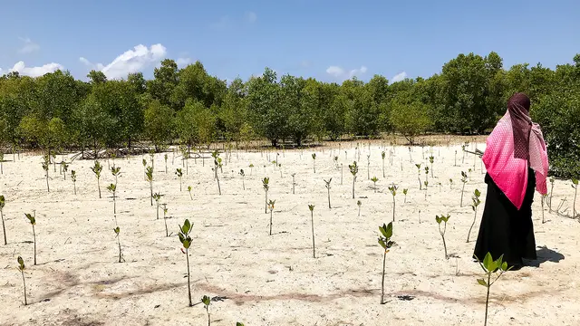
At sunrise, women draw water from the well in Dlonguebougou, Mali (Photo: Camilla Toulmin, IIED)
Conflict between herders and farmers in West Africa is seen by some as an age-old problem. But for the villagers of Dlonguebougou in Mali, livestock and crop production had for many generations been valuable and complementary activities.
Herders brought their animals to water at Dlonguebougou’s wells, providing dung in return, which kept the soils in good health. Villagers had also built up holdings of cattle, sheep and goats, plus oxen with which to plough the land.
In 2009, the Malian government handed out a large area of land for an irrigated sugarcane plantation. Hundreds of farmers displaced by the plantation have since flooded into the area around Dlonguebougou, putting pressure on land and ploughing up grazing lands to grow cereals.
Pasture for herds has become scarce and many farmers’ fields block the corridors needed to move animals from water to grazing areas.

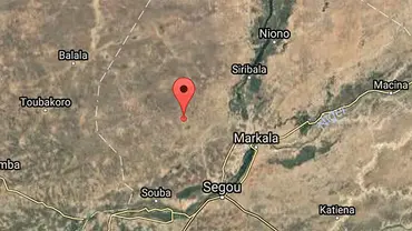
The star shows the location of Dlonguebougou in Mali, and the surrounding region

An aerial view of Dlonguebougou from January 2025. Over 40 years the village area has multiplied five-fold (Image via Google Earth)
Displacement around Dlonguebougou
Dlonguebougou is a long-established Bambara farming settlement of 1,600 people which lies 50km north of the River Niger at Ségou, and 30km to the west of the rice fields of the irrigation scheme, the Office du Niger.
Legislation from colonial times allows the state-run Office du Niger to allocate land to private enterprises with no compensation to customary landowners.
In 2009, the government agreed to give 20,000 hectares of irrigable land to a Chinese company to grow sugarcane, displacing hundreds of families from villages such as Tékéna and N’Golobabougou who had been farming the land for centuries. These villagers had to load their carts and set off northwards in search of farmland around Dlonguebougou and neighbouring settlements.
Villages like Dlonguebougou used to have abundant land, with enough to maintain a fallow system and sufficient grazing for their animals and visiting herds.
However, as can be seen from the diagram below, there has been a large increase in cultivated land, much of which is made up by incoming farmers evicted by the sugarcane company.
Click on the terms in the key to deep dive into the data by comparing or highlighting various categories (Data: Camilla Toulmin/Kate Lines)
In 2020, there were 72 incoming families farming around Dlonguebougou, most of whom have arrived since the evictions of 2009.
The consequences from this inflow include:
- A shorter fallow period for farmland and declining soil fertility
- Less grazing land so there are fewer cattle coming to water at Dlonguebougou, leading to less manure and lower crop yields
- Conflict between farmers and herders has become more frequent, and more violent, as herders have lost access to critical grazing and water resources, and
- Millet harvests have suffered as soils lose the valuable livestock manure which used to bring good yields.
Much more rain has been falling
Some argue that climate change is the cause of conflict in the Sahel. However, the last 20 years have seen rising levels of rainfall across the region. Rainfall data from Dlonguebougou show how recent years have been much wetter than in the 1980s.
The pattern of rainfall has also changed, with today’s more concentrated in a shorter rainy season and arriving in larger, more intense storms, as shown by the diagrams below.
Charting rainfall in Dlonguebougou 1983-2023

Diagrams showing how much rain falls and when from the 1980s to 2023 in Dlonguebougou. Click on the image to enlarge it (Images: Kate Lines)
Heavier rainfall and re-greening of the dryland landscapes has been underway across much of the Sahel for the last 20 years, so the common narrative of climate change driving conflict does not fit the facts.
Rather, it is the persistent encroachment of fields into grazing lands which has generated anger among livestock herders. Such anger at the government’s inability to manage land use conflicts has led many rural dwellers to join jihadist groups, because they feel these groups can better protect their interests.
The causes of conflict
In 2021, the village of Dlonguebougou was surrounded by fighters from the Group to Support Islam and Muslims (GSIM) armed group, which maintained a siege lasting four months, covering the entire farming season.
It was impossible for villagers to go out and cultivate their fields without fear of being shot.
The village imam said: “We were completely blockaded, no-one could leave or come to the village. The jihadists encircled the village, hidden in the bush day and night. We heard gunshots morning and evening. All of our cattle were rounded up by the armed men and taken away. No-one could set foot outside.
“All of our foodstuffs were running low. One day in late August, we decided to club together to get food supplies from the local market. We took two moto-tricycles, protected by several armed men, and they set off to the market at Dougabougou, where they filled them up with rice, tea, sugar, salt, kolanut, soap, peanuts, okra and other good things.
“On their way home, just 3-4 kms from our village, they were attacked by the jihadists who shot and killed three of our people, and captured all our food, and the moto-tricycles. So then we realised we had to surrender.”
A meeting was arranged between the GSIM and a delegation from the village. In return for peace, the villagers agreed to give up their guns and follow Islamic law.
They must keep fields away from livestock routes and keep the edges of watering ponds clear of farming. No green trees are to be cut down and charcoal making is forbidden. Women must be veiled in public and no loud music or dancing is allowed. All schools have been shut down, and only Islamic madrassas are allowed. A zakat (a form of Islamic tax) must be paid to the GSIM, currently levied at half of the villagers’ cereal harvest.
As long as these rules are kept, the villagers can go about their business, travel safely and farm the land without difficulty. And for the last three years, conditions have been peaceful.
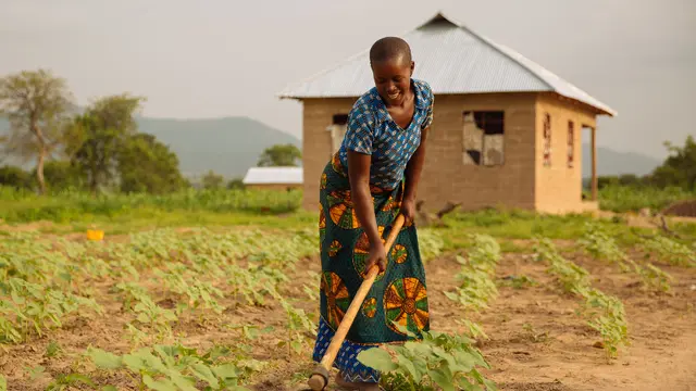
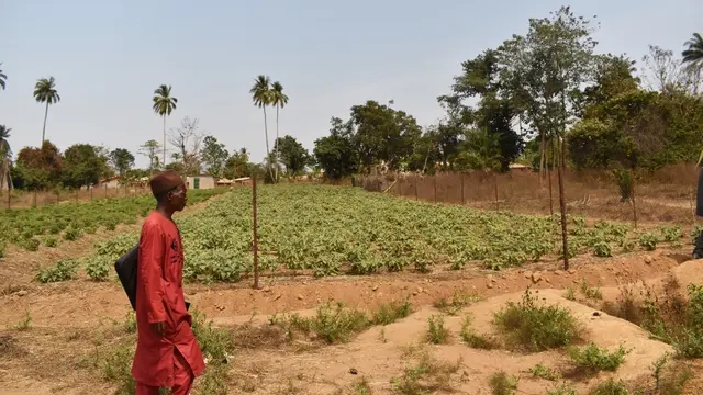
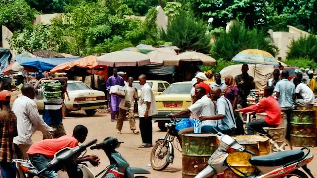
Photo gallery


")

Photos of Dlonguebougou. Click on any image to expand it and then scroll through the gallery (Photos: Camilla Toulmin, IIED)
Lessons from Dlonguebougou
In much of central Mali, the uncontrolled expansion of cultivated land into grazing areas has inflamed relations between livestock keepers and farmers. Over decades, government has failed to provide a fair, accessible system for resolving land use disputes, and actively promoted farming at the expense of livestock production.
Those from a herding background feel a keen sense of injustice towards their rights and needs. Groups such as the GSIM establish rules in the areas where they govern which seek to provide better conditions for herders.
Yet farmers have also suffered from state actions, as seen by the eviction of hundreds of families displaced from their customary lands for the sake of a Chinese-owned irrigated sugarcane plantation.
Such irrigation developments are increasingly questioned not only as poor value when compared with broader support for development of rainfed drylands. But there are serious concerns about the downstream impacts of increased irrigation, as it deprives high value wetland areas, such as the inner Niger Delta, of much needed water to sustain pastures, rice fields and fishing for millions of people.
Governments across the Sahel seek military solutions to deal with the legacy of longstanding injustice, incompetence and corruption. The vast rural spaces involved and the depth of anger felt between different groups demand a different approach.
Establishing dialogue between rural dwellers and recognising traditional chiefs and religious leaders as key figures in rebuilding trust, can help address and move beyond their differences, and create local arenas to resolve common problems.
Related reading
Cultiver, migrer, investir. La vie d'un village sahélien (1980-2020), Camilla Toulmin (2024)
Land, Investment, and Migration: Thirty-five Years of Village Life in Mali, Camilla Toulmin (2020)
Insight: Countering desertification and defusing climate wars: why myths matter, David Pertaub, Florence Crick (December 2024)
Author
Camilla Toulmin ([email protected]) is a senior associate in IIED’s Climate Change research group